Cable Touchdown Inspection in a High Current Area
This project involved the survey for a cable route as well as a cable touchdown survey for the placement of power and communications cabling from the mainland to a major island through waters with high tidal currents. The cable would stretch over an area of 30 kilometers and would require a powerful ROV to aid the construction team in placing the cables correctly. The power line project survey area crossed the Georgia Strait between Vancouver Island and mainland Canada where currents during operations were in excess of 2 knots. In order to begin each project, the Hibbard Inshore team assesses the survey location for its particular challenges in order to select the optimal vessel, remotely operated vehicle (ROV) and survey equipment spread. Hibbard Inshore has worked for years to develop appropriate methods and equipment to address a wide variety of marine construction and inspection applications, and these projects were no different. The unique challenge for each of these was that while the survey areas were not very deep by ocean standards, the tidal currents were extremely brisk.
Prior to hiring Hibbard Inshore, the customer had performed a side scan sonar survey to identify a likely route for the cable lay; however, because the side scan head was still quite a distance from the actual bottom, the customer wanted to use an ROV to confirm if several questionable locations would be suitable for the cable placement.
They hired Hibbard Inshore to perform a pre-lay survey including spot checking the planned cable routes through rocky areas and over cliffs to verify the best route had been chosen. Once the pre-lay survey was completed, and the final cable route was confirmed, the customer hired Hibbard Inshore to perform a survey of the cable as it was laid in place. This touchdown survey required an ROV that could maneuver during changing tidal currents to provide uninterrupted cable touchdown location to the lay vessel.
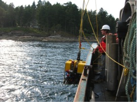
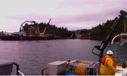
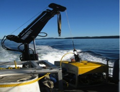
Because of the conditions, the team decided on using the Mohican ROV due to its ability to stay stable in the project environment. The Mohican vehicle was flown in live-boat configuration eliminating the LARS and TMS so a smaller vessel could be used for the project. A full navigation suite was also provided with USBL tracking, GPS, Gyro Compass and IMU. Radio telemetry was provided to send the ROV position and video to the lay vessel.
The Mohican ROV used in these projects has a high thrust to size ratio, and the live-boat configuration reduced the available cross-sectional area of the equipment allowing it to fight the current more efficiently. The live-boat configuration reduced the overall size and weight of the required equipment allowing the use of a smaller crew and small vessel of opportunity. One major advantage was that the vessel did not require a mooring system or a dynamic positioning system to maintain the position of the ROV. Productivity was maximized because time was not required to place and move anchors across the survey area, and the ROV could be deployed very quickly to take maximum advantage of the lower current periods afforded by the change in tides. Additionally, the smaller systems and vessels are comparatively easy to mobilize.
For this project the survey depths ranged up to 200 meters. This sort of ROV and vessel setup can be advantageous for a survey area as small as a single bottom placed sensor or alternatively can be used over a much larger area such as for the Georgia Strait project which required three passes of the entire route for each cable covering a total of approximately 250 kilometers. Due to the selected methods and equipment, the Hibbard Inshore team was able to complete each survey scope within schedule making each project a success despite the difficult currents.